Every year my work schedule plays out a little differently but it always includes a far west Texas site visit in Culberson County and takes me very close to the Guadalupe Mountains (I can usually see the mountains in the distance during my site visit). Last year I waited until the Fall to make the trek just so I could swing by McKittrick Canyon and experience its autumn leaf change for the first time. This year I knew I wanted to swing by the Nature Conservancy's open preserve weekend at the Davis Mountain Preserve and also decided to put Seminole Canyon State Park, Balmorhea State Park, and the Guadalupe Mountains National Park on the itinerary.
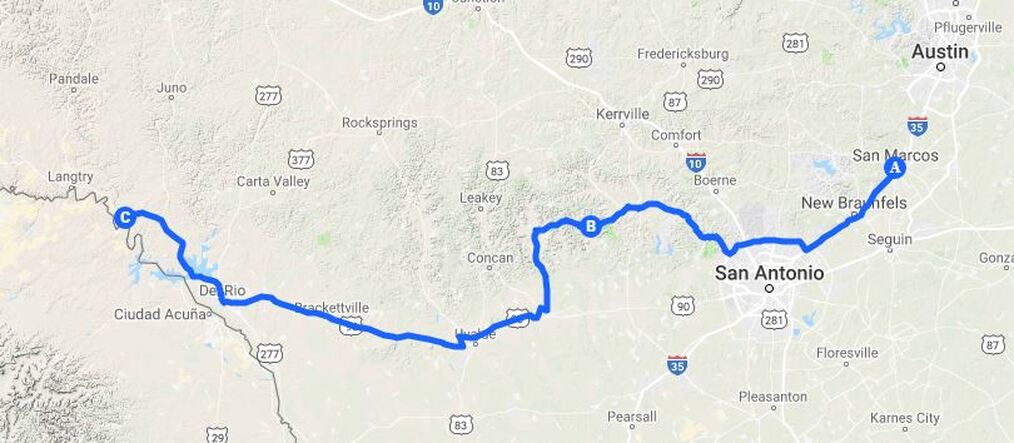
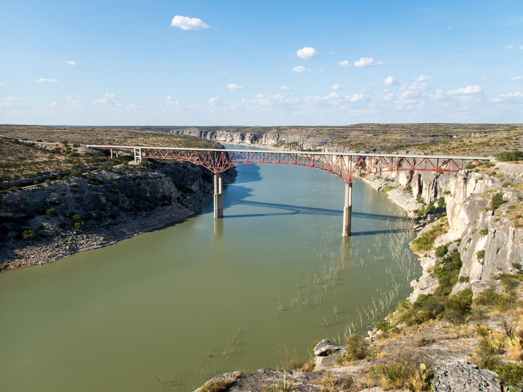
My first day on the road started with a work site in Bandera County (a strategic piggy-back to efficiently fit work and vacation together) on my way to Seminole Canyon State park in the afternoon. Temperatures were scorching, at least 106°F and I knew there wasn't any escape from the heat in the State Park so I moseyed around the nearby Pecos River Bridge to clock a little more AC-in-the-car-time before going into the park.
My first day on the road started with a work site in Bandera County (a strategic piggy-back to efficiently fit work and vacation together) on my way to Seminole Canyon State park in the afternoon. Temperatures were scorching, at least 106°F and I knew there wasn't any escape from the heat in the State Park so I moseyed around the nearby Pecos River Bridge to clock a little more AC-in-the-car-time before going into the park.
The Pecos Highway Bridge was built in 1957 and is the tallest highway bridge in Texas at 273 ft. There is also an older railroad bridge further upstream that was taller than this highway bridge, at least in previous iterations if I understand correctly. Before the high bridges were built the trains followed a narrow path along the bluffs of the Rio Grande River and through two tunnels which have long since been abandoned. Here is a great write-up about one of the tunnels.

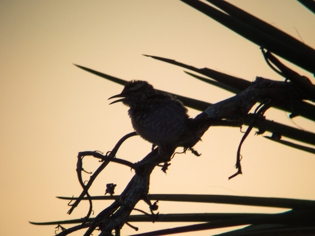
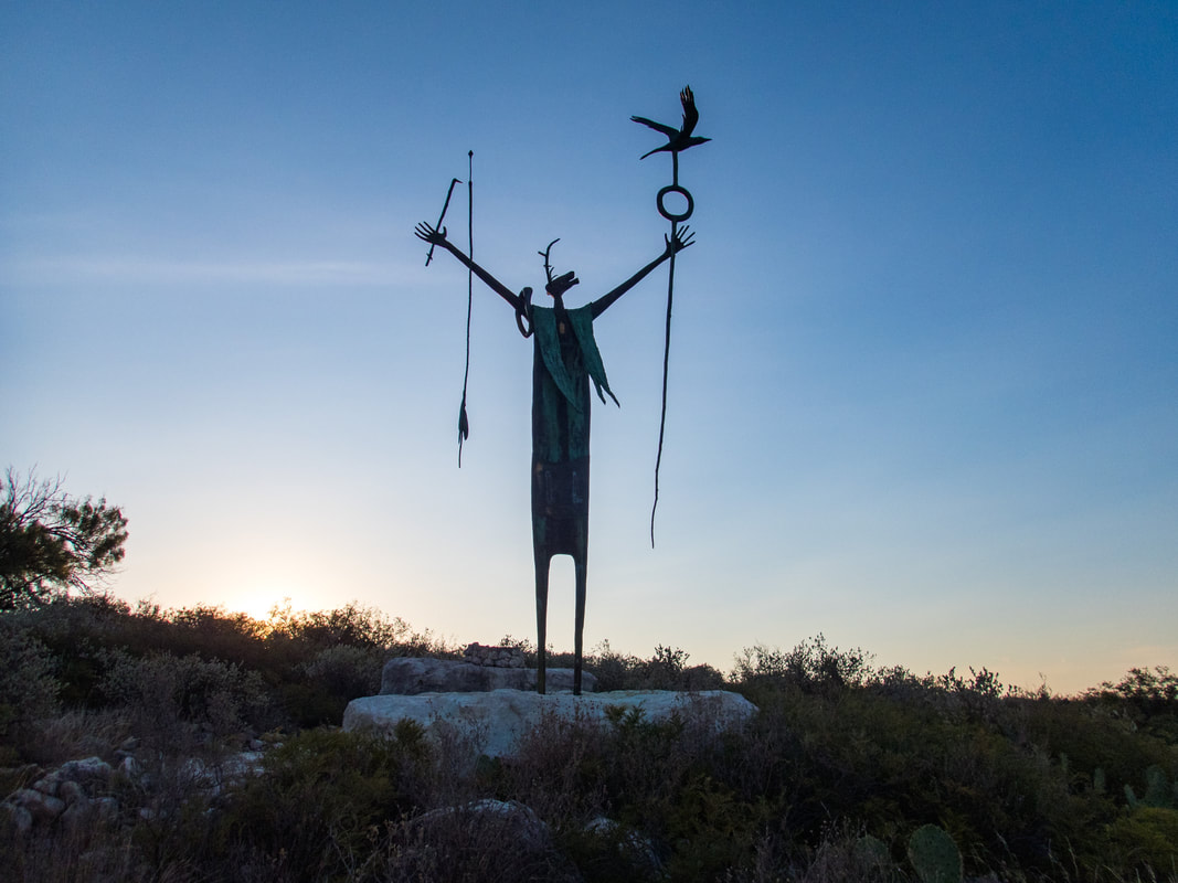
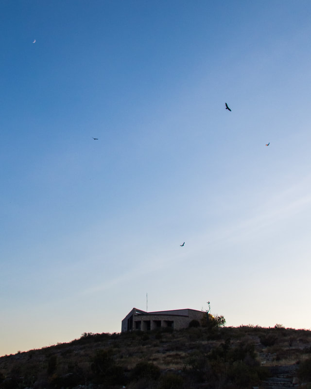
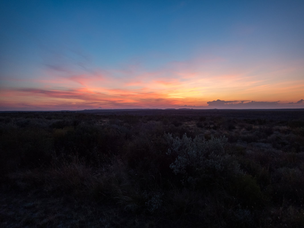
I finally drove over to Seminole Canyon State Park but the headquarters were closed for the day and I didn't see a single other person around. I don't think this park is very popular during the summer. After I got my campsite selected and registered I took a short walk behind the visitor center as the sun slowly lowered and the east-facing hillsides became shaded. After I had done some slow hiking in the 106°F sun the shaded hillside felt amazing. A few moments later the wildlife began to stir. I became instantly excited once I saw a White-throated Swift. We see Chimney Swifts all over San Marcos and in the Hill Country so these beautiful White-throated Swifts found in the west were a welcomed delight. I then began to notice cave swallows and they were all circling closely overhead as they left their canyon roosts. There was a small draw straight below me (and the bigger Seminole Canyon to my right) and I noticed a couple of vultures leaving their shelters from this draw as they aimed for the canyon gusts. It appeared to be a family of 5 turkey vultures, 3 immature birds with black heads and 2 adults with the typical red heads. They all rose higher and higher together to take advantage of the beautiful evening as the heat waned and I imagined the immature birds were still learning the ropes and mastering how ride the wind. Black-throated Sparrows, Canyon Wrens, Cactus Wrens and others were all calling and singing to make their final statements of the day. I sat and soaked it all in, the birds, the warm breeze, and the special feeling you get when you're close to prehistoric painted shelters. Humans lived in and around these canyons many thousands of years ago. I felt totally at peace and happy to be there. One special note on the cool statue behind the visitor center, this statue is inspired from one of the nearby cave paintings and I love how it brings the cave painting to life, turning the mystical being/message/story into something completely tangible.


I had been wanting to return to Seminole Canyon for many years but everytime it seemed just out of range. The last time I was here was in 2012 with my friend Derrick at the tail end of a spring break Trans-Pecos tour, and only briefly to camp. In 2009 I had a chance to take the guided tour of the cave shelter and see the pictographs. Unfortunately there weren't going to be any tours available during my Monday/Tuesday visit but that just made it a great opportunity to check out the Canyon Rim trail and go down to the bluffs of the Rio Grande River.
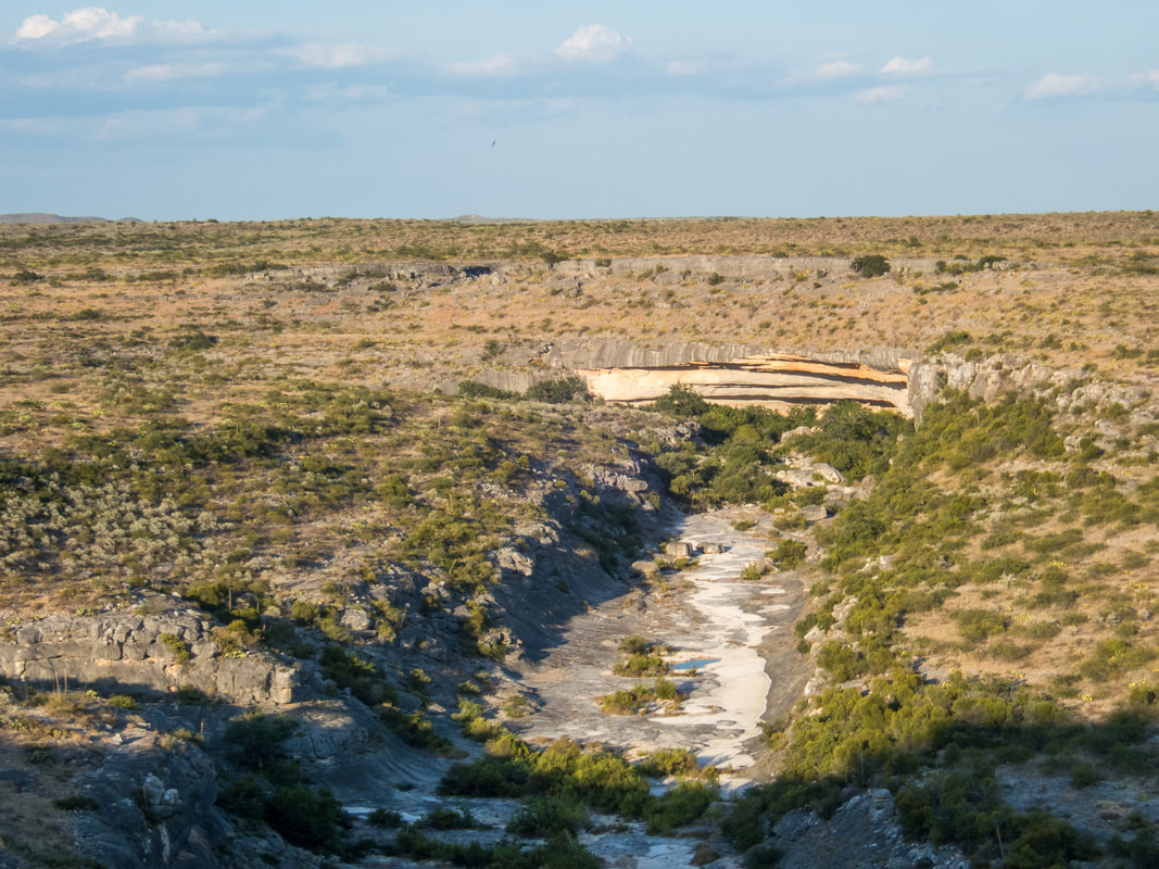
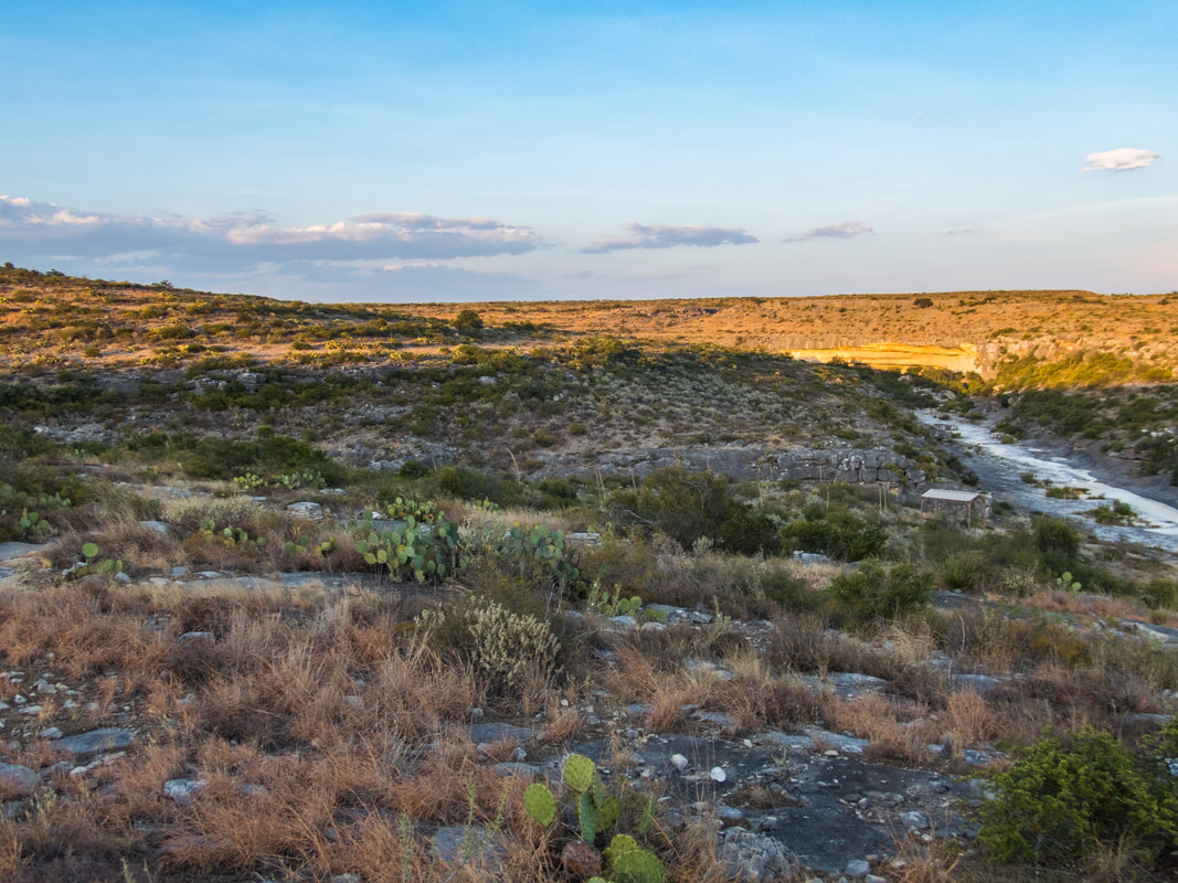
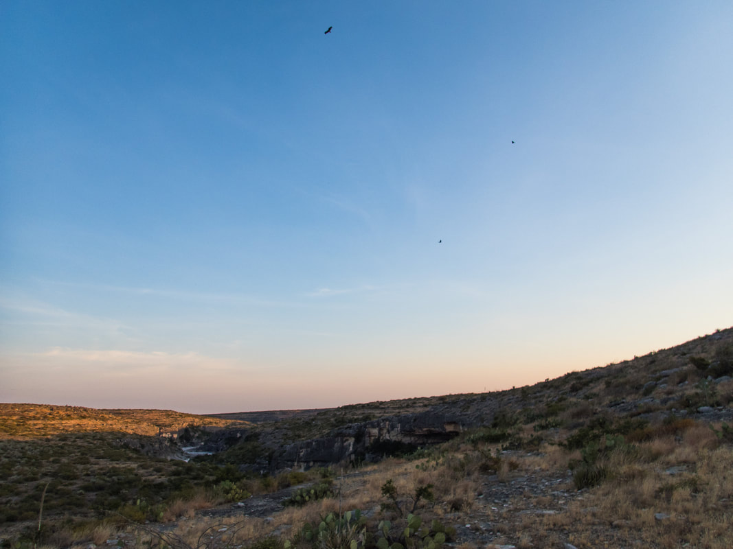
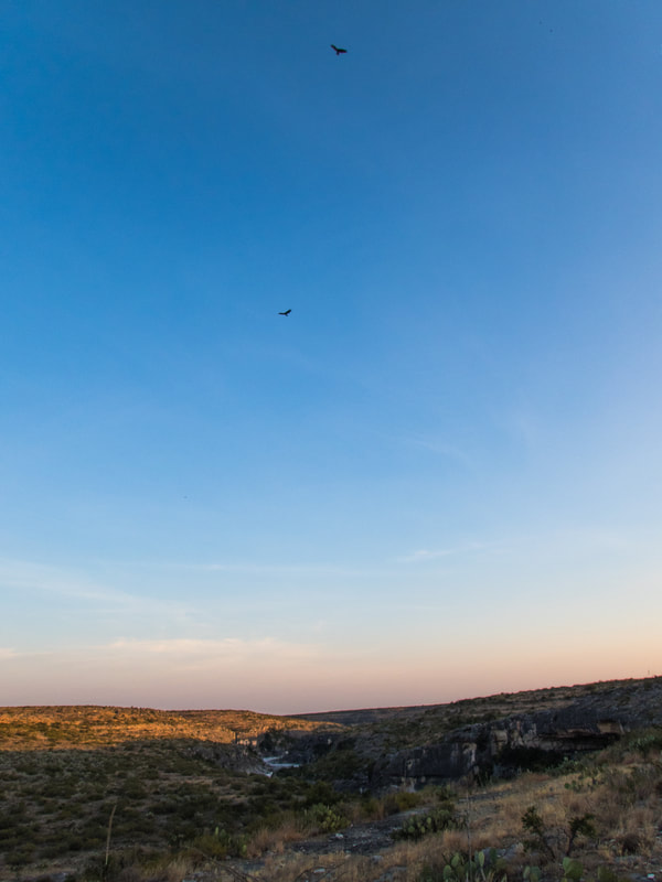
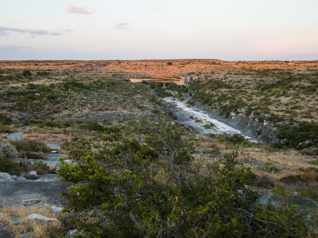
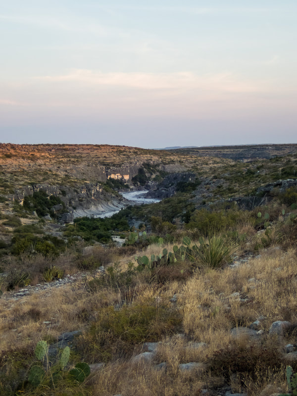
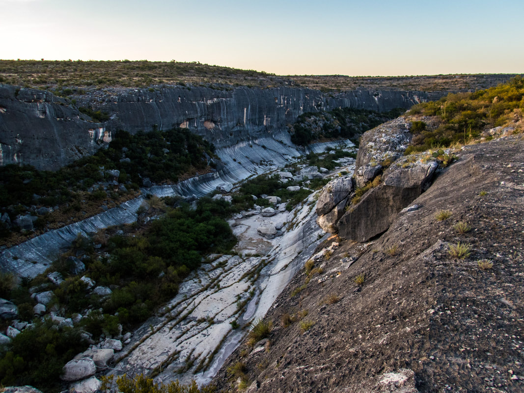
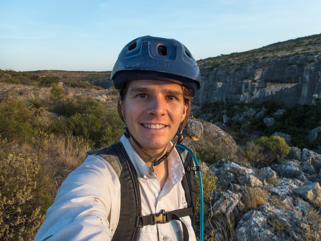
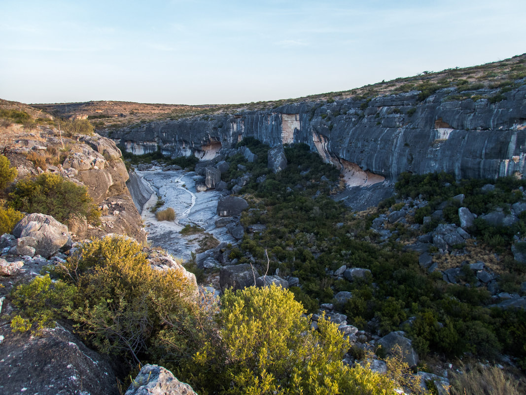
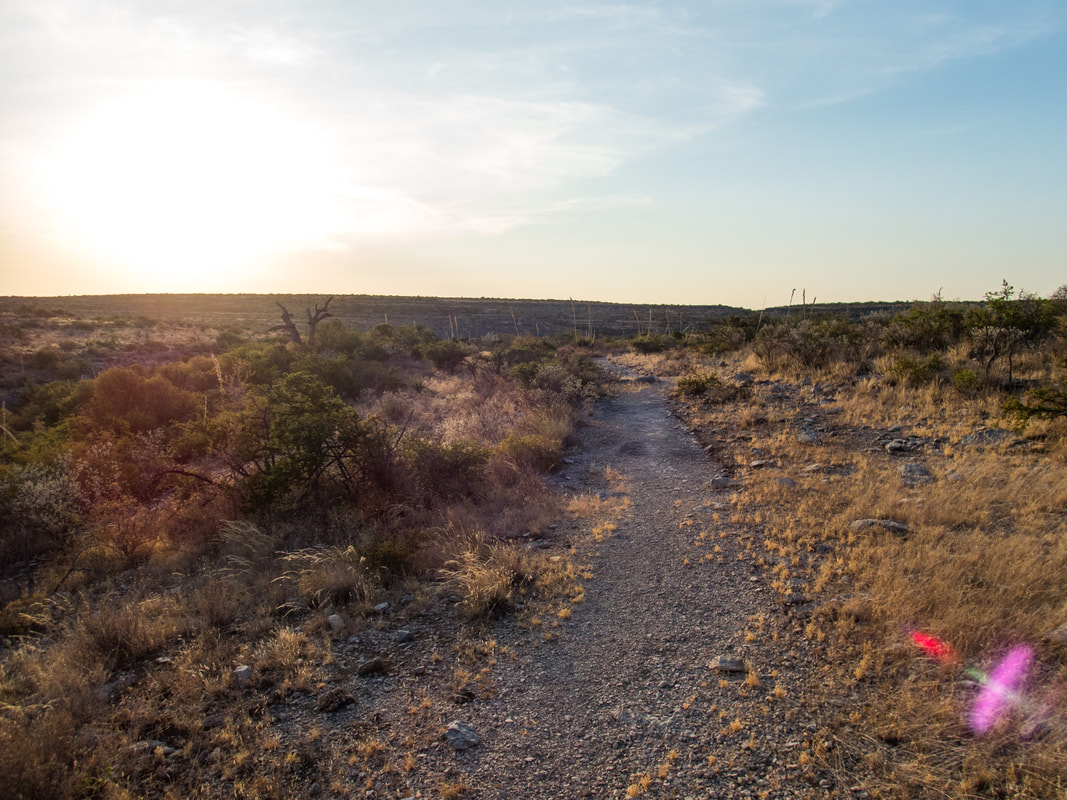
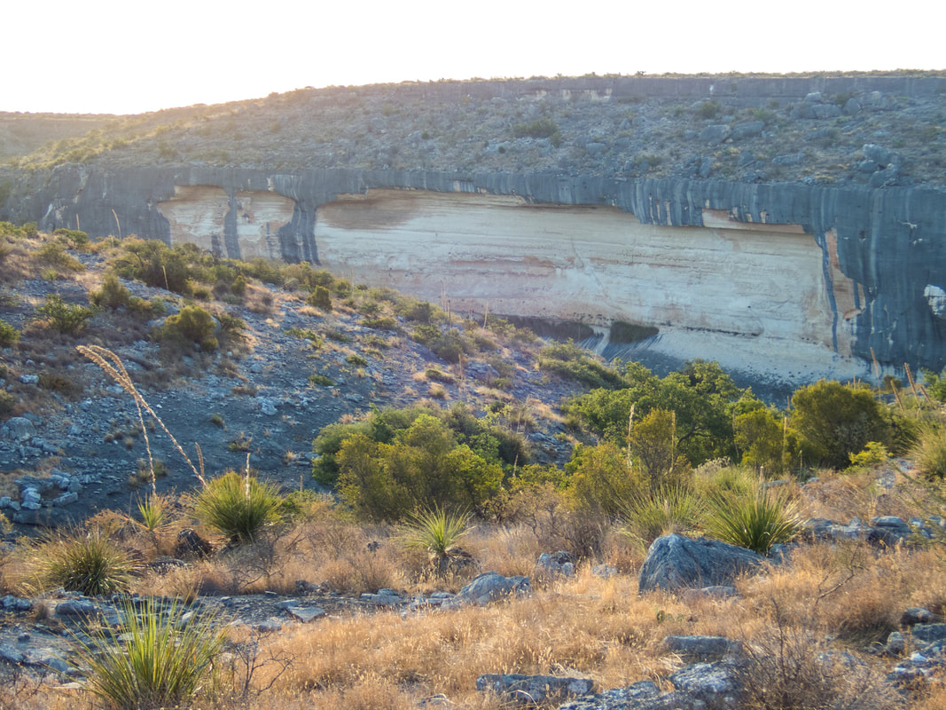
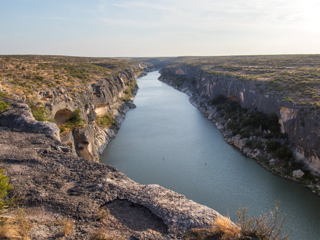
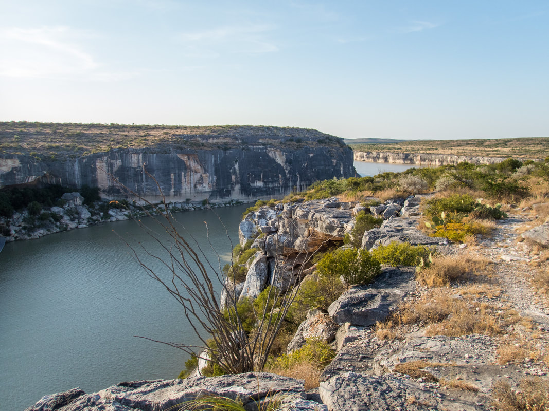
I woke up before dawn to pack up my campsite, wash up, and gear up for a bike-hike along the Canyon Rim trail. I knew this was the only reasonable and safe way to see this landscape at this time of year because I didn't want to get caught in the midday summer heat. My mountain bike got me to my first destination in a heartbeat. The Presa Canyon overlook. I was totally impressed. Presa Canyon is a beautiful canyon that pours into Seminole Canyon before it all reaches the Rio Grande River. The overlook gave a great view looking up and down Seminole Canyon and this confluence with Presa Canyon, these bluffs were about 100 ft tall. There was a pool of water at the confluence and wonderful echos of the Canyon Wren.
I woke up before dawn to pack up my campsite, wash up, and gear up for a bike-hike along the Canyon Rim trail. I knew this was the only reasonable and safe way to see this landscape at this time of year because I didn't want to get caught in the midday summer heat. My mountain bike got me to my first destination in a heartbeat. The Presa Canyon overlook. I was totally impressed. Presa Canyon is a beautiful canyon that pours into Seminole Canyon before it all reaches the Rio Grande River. The overlook gave a great view looking up and down Seminole Canyon and this confluence with Presa Canyon, these bluffs were about 100 ft tall. There was a pool of water at the confluence and wonderful echos of the Canyon Wren.

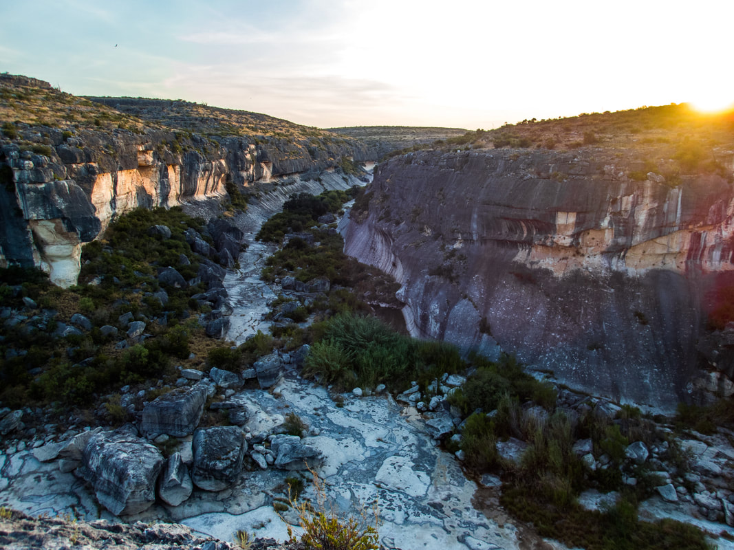

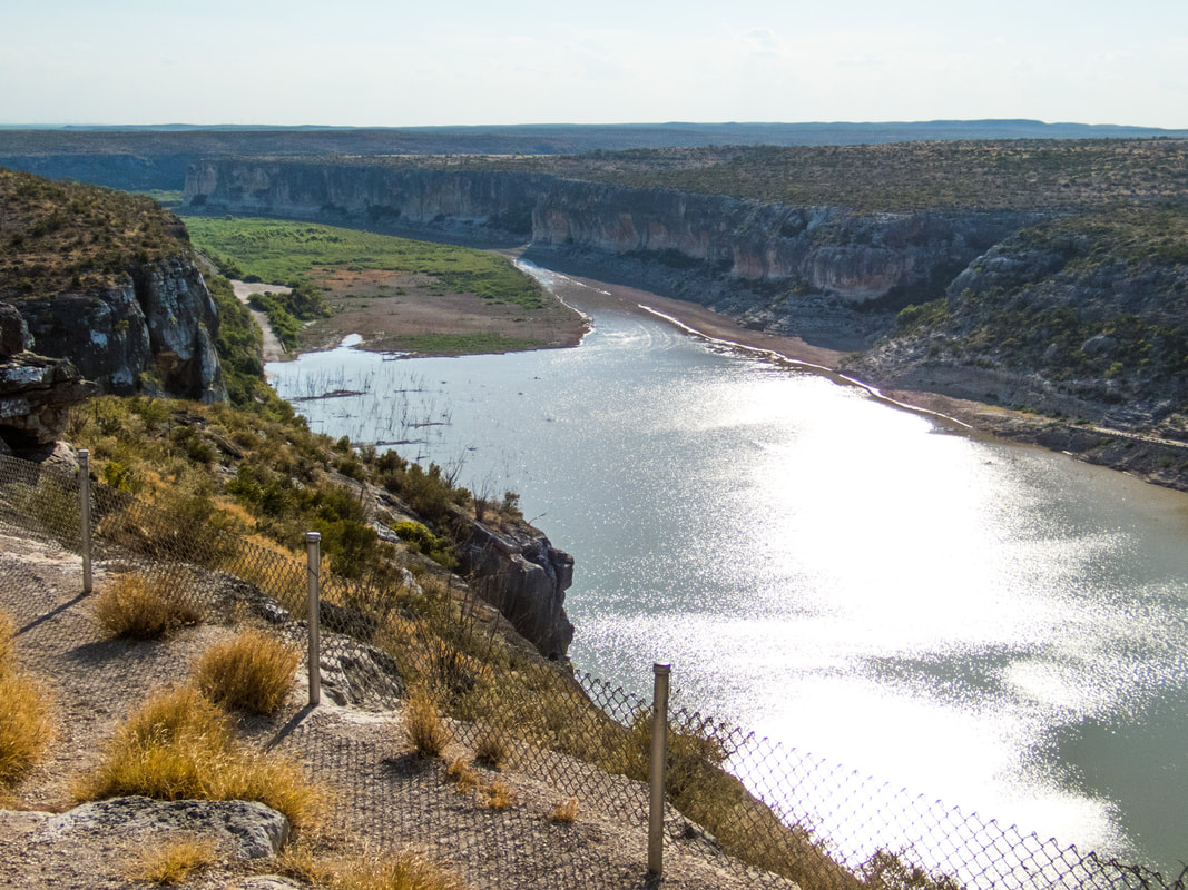
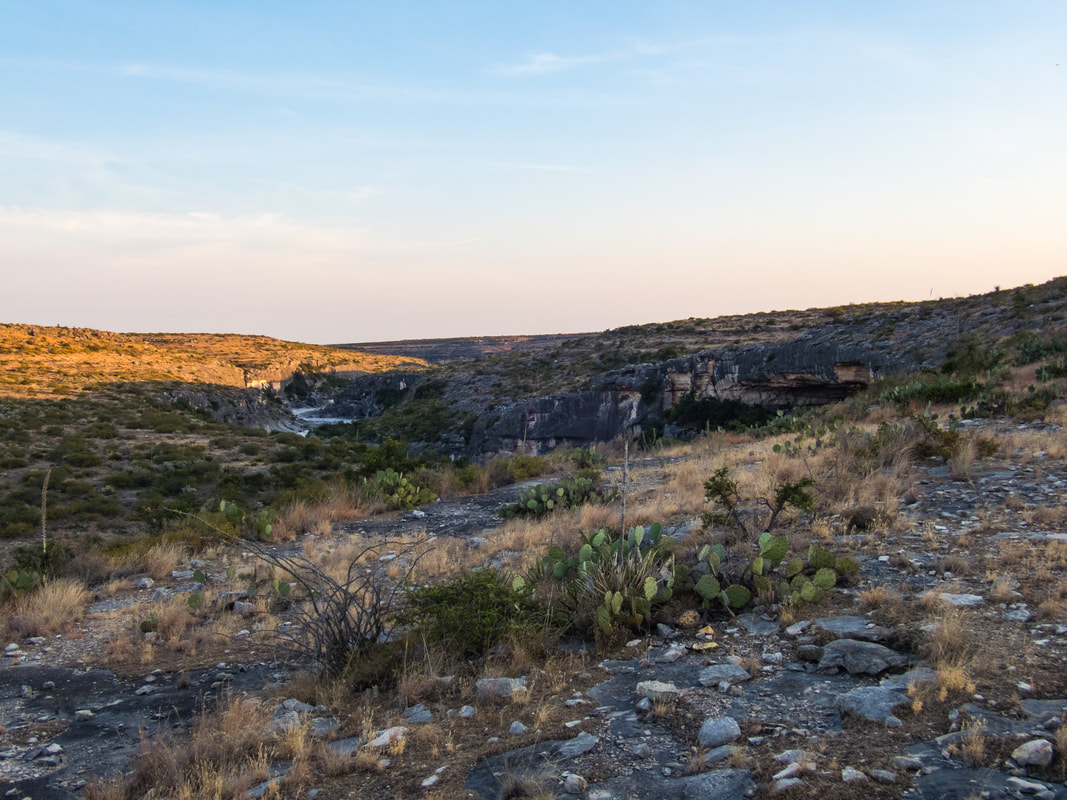
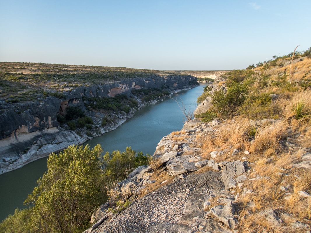
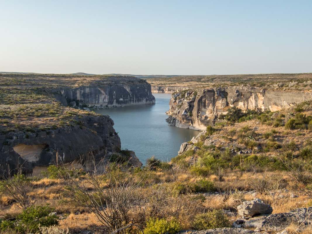
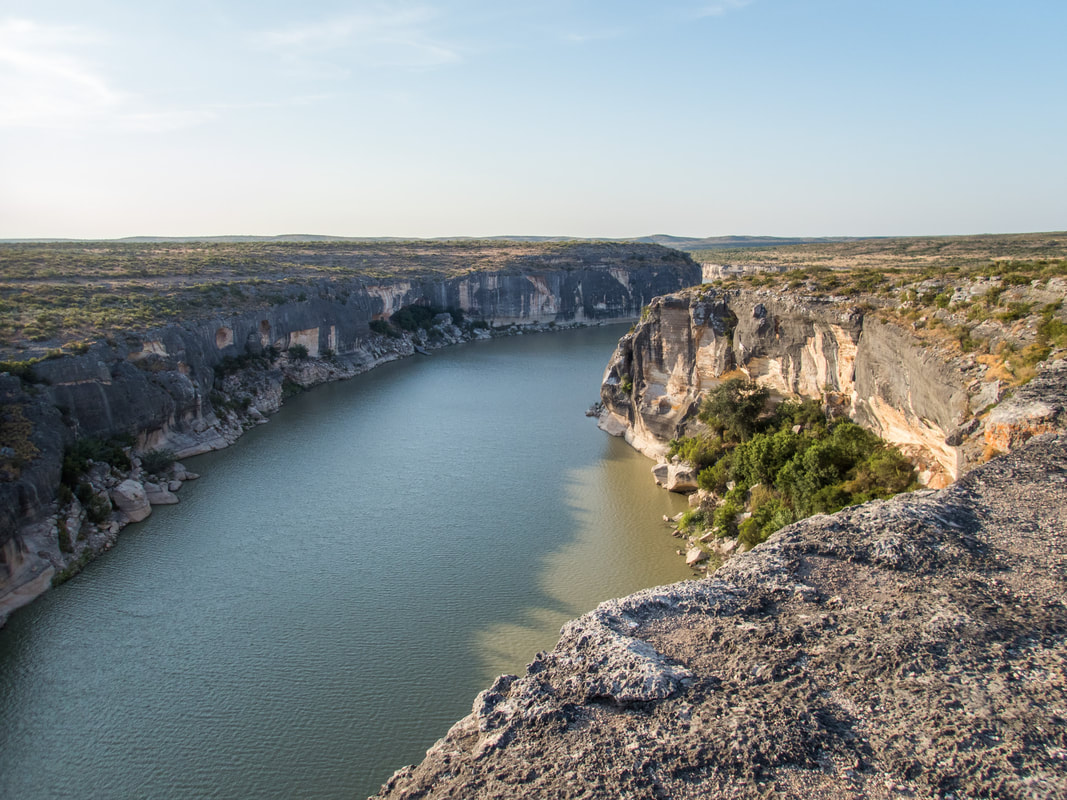
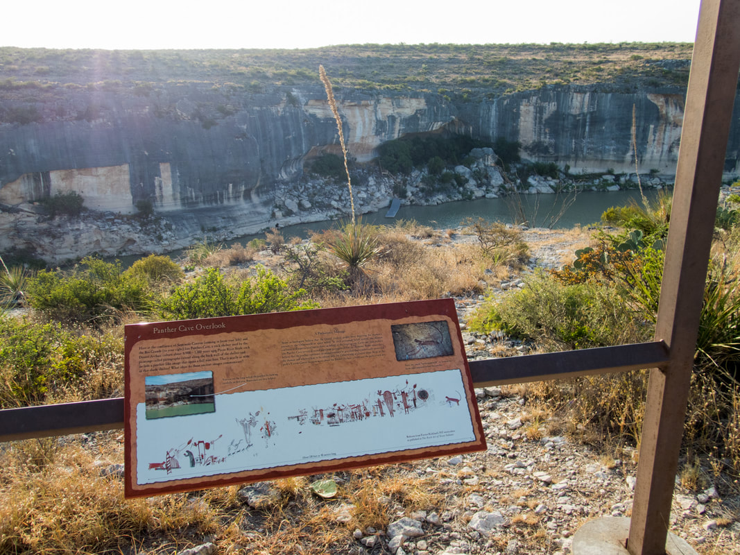
My route to Presa Canyon was mostly on the easy jeep road and along some easy singletrack for the last third. My next destination was going to take me along the whole canyon ridge and the trail condition/difficulty was an unknown factor. I actually had a scare about half way through this second stretch when I noticed my back tire rubbing against the bike frame. I had plenty of water so I would have survived being stranded on foot but it wasn't a situation I wanted to be in. A flat tire or any malfunction could put me in that spot really quick. My short scare was resolved by just opening up the quick release and realigning the wheel which had apparently shifted from some rocky off-camber stretches, and I made sure to clamp the wheel tighter than it was. I didn't have any problems after that but I was spooked enough thinking about having to walk all the way back. I finally made it to the lower overlooks, not quite on top of the Rio Grande but I could see it (I chose not to go any farther). There were a couple overlooks and one of them points directly at the Panther Cave shelter with a famous panther image depicted. As the sign suggested, I could actually see the back half of this panther with my binoculars across the river so that was pretty cool. I could also see the dock that helps access the cave and the chainlink security fence completely blocking it off from trespassers. The water in these images is all backwater of Lake Amistad. The lake was formed in 1969 and sadly submerged a number of cave painting sights, canyons, and even the third largest springs in the state, Goodenough Springs. That's just behind Comal and San Marcos Springs in size/flow.
I wrapped up my bike-hike by taking the quick jeep road back and spent an hour in the visitor center reading and learning about the history of exploring and settling this region. It was all thanks to the windmill and the railroad.
I wrapped up my bike-hike by taking the quick jeep road back and spent an hour in the visitor center reading and learning about the history of exploring and settling this region. It was all thanks to the windmill and the railroad.
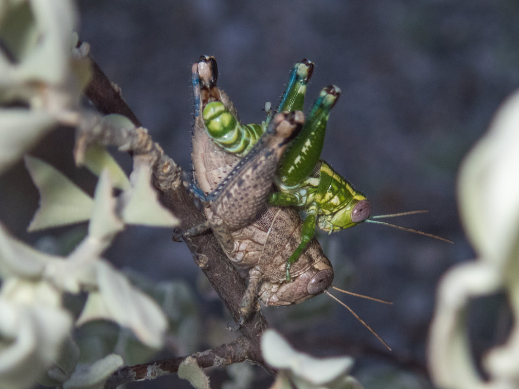
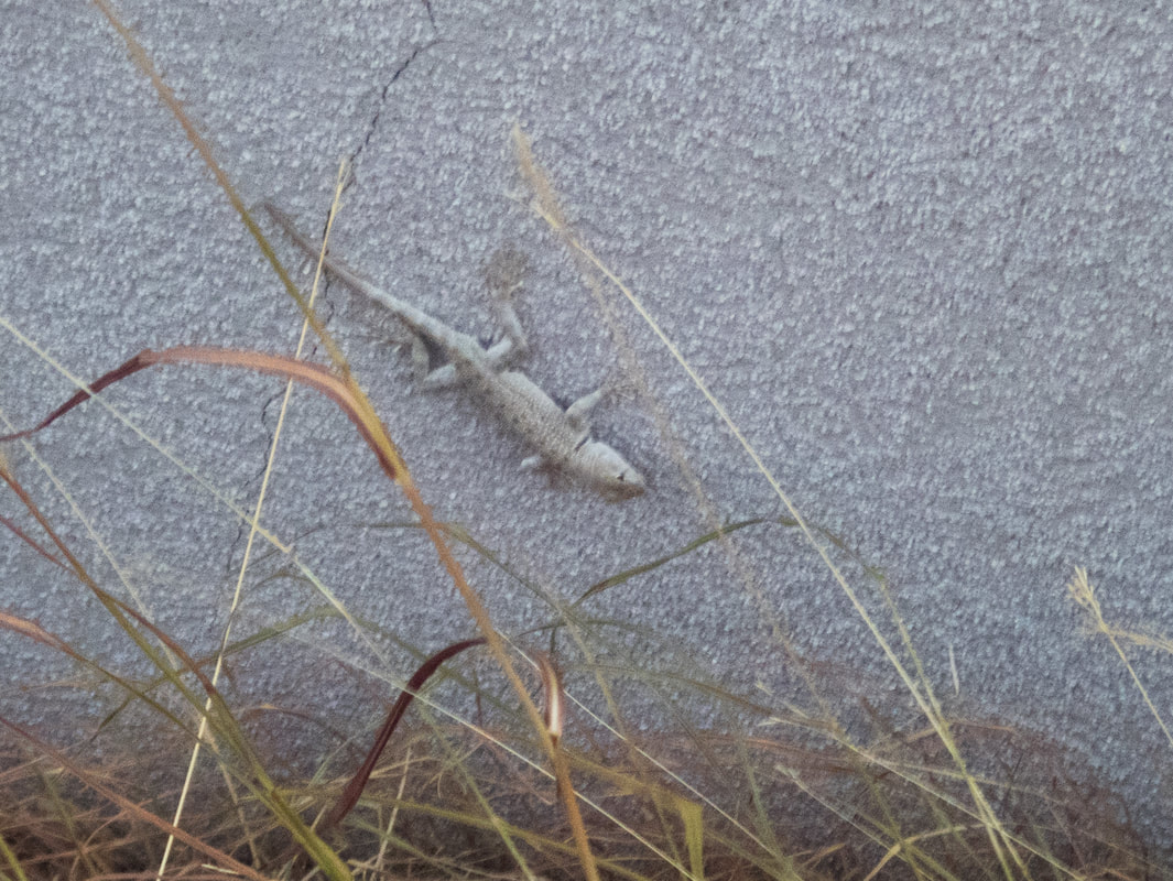
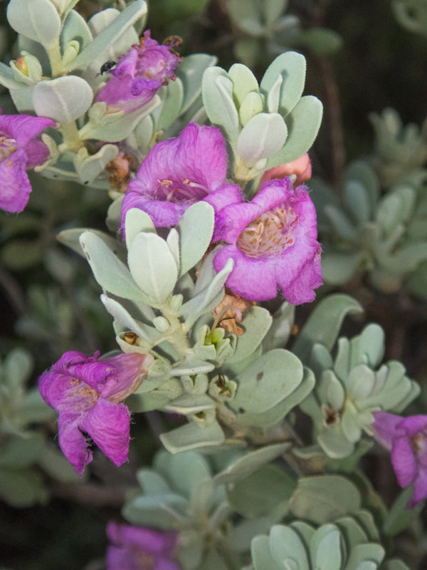
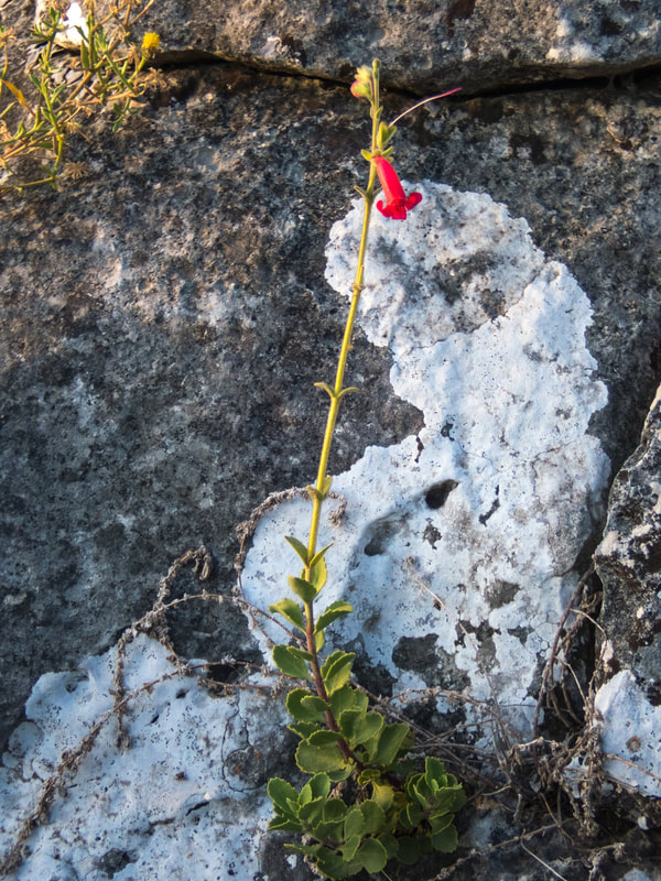
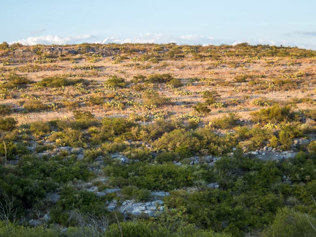
Here are a few plants and critters from these two days. I decided to leave the carcass out of the story leading up to Presa Canyon. I could have tried to convince myself it was some sort of omen but I was just interested in the natural history of it and didn't think twice about it in the moment. I think it's a skunk.